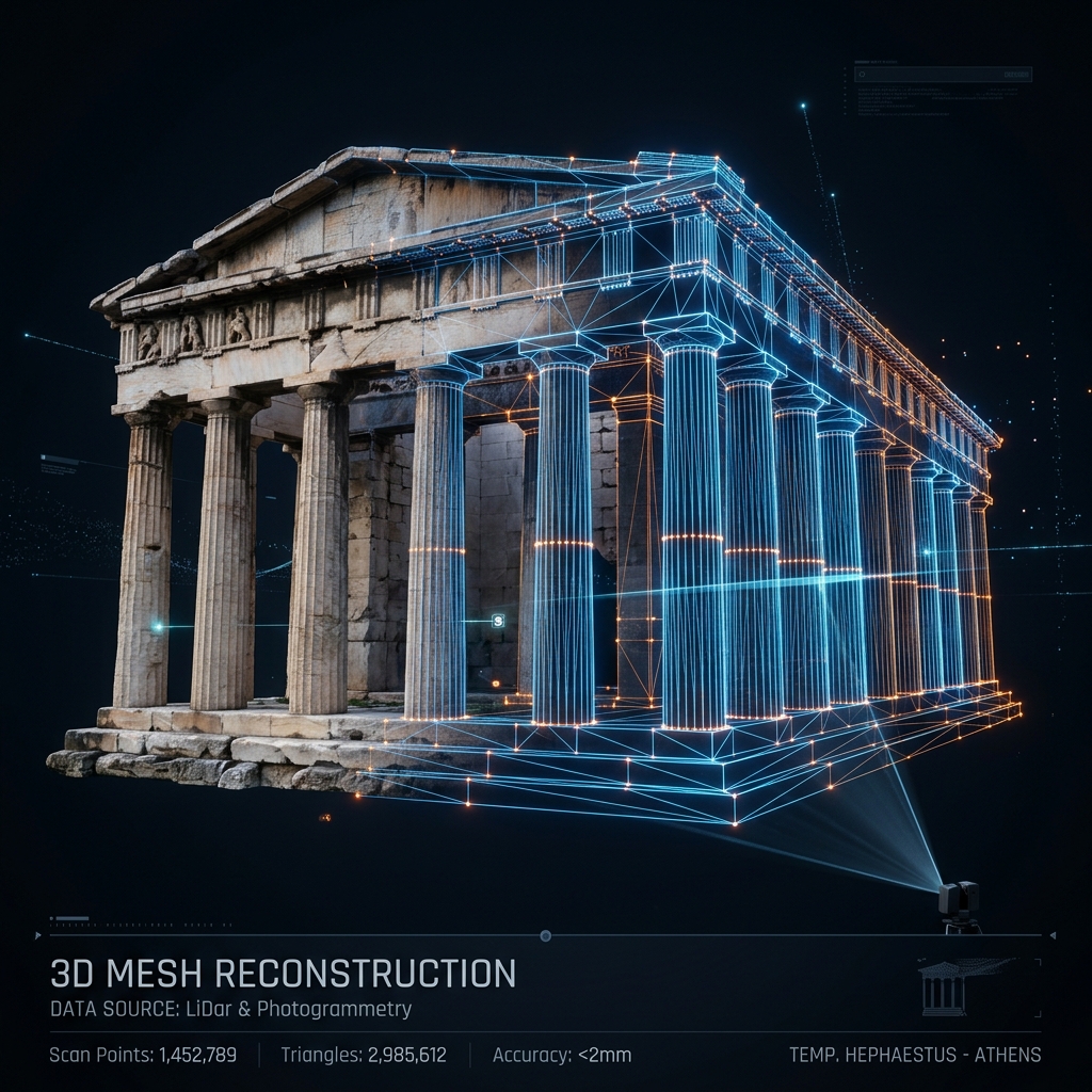
Reality as measurable 3D
Translating hundreds of calibrated photographs into dense point clouds, textured meshes, and orthomosaics with millimeter accuracy.
1.25 mm/px
GSD capturing millimeter surface variations
45 MP
Full-frame optical array per exposure
± 2
Millimeter margin of error across 10m segments
3D Photogrammetry
Precision: Millimeter-level
Deliverables: Textured Meshes & Point Clouds
Metro Venizelou Rescue Excavations
Millimeter-accurate 3D reconstruction of the Byzantine Decumanus crossroads and structural excavation layers.
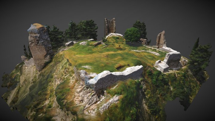
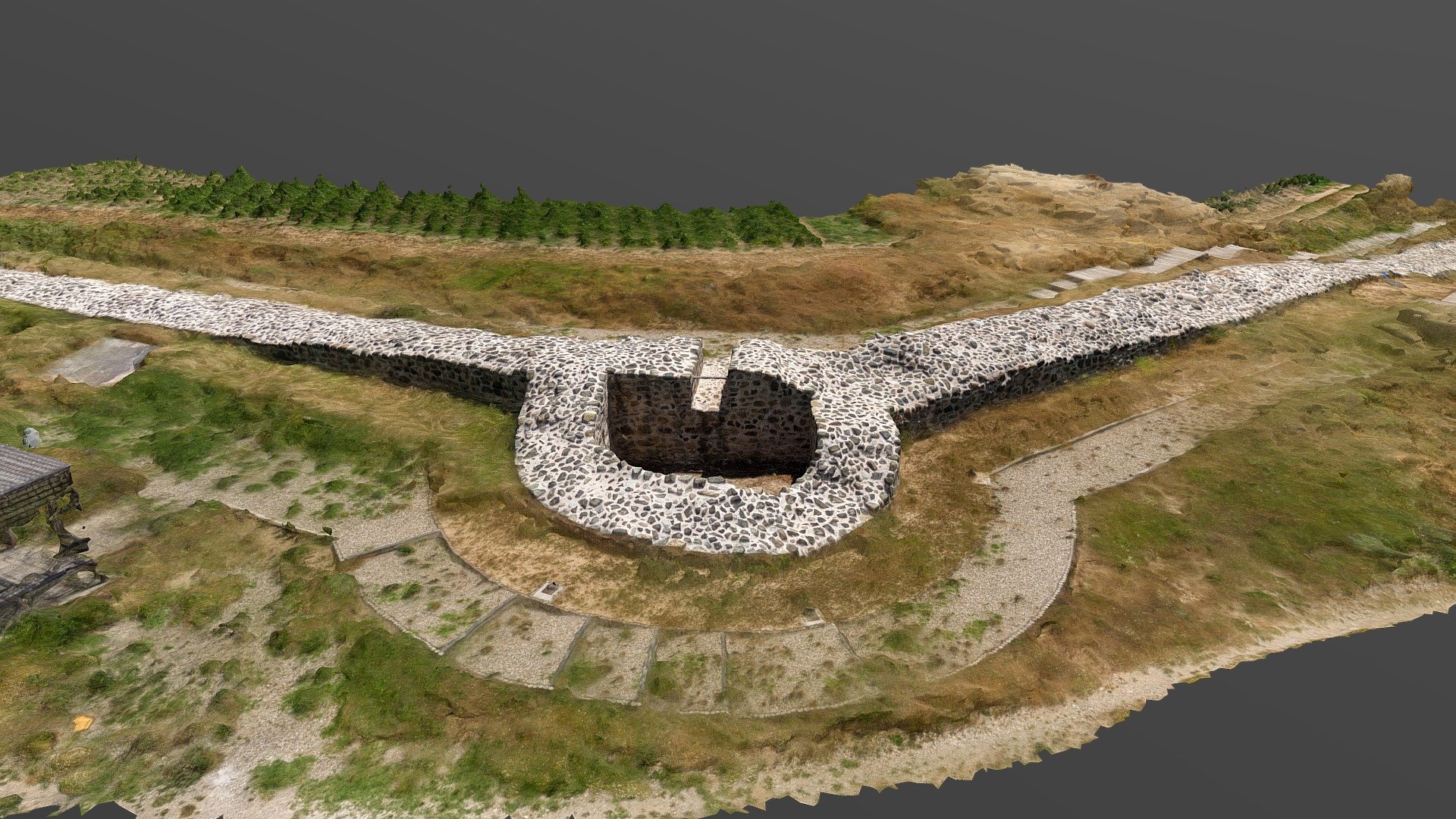
Eptapyrgion Fortress Walls
Complete 3D spatial scanning of the fortification walls, towers, and interior structures of the historical castle.
Medieval Fortress of Servia
Digitizing the defensive walls, towers, and Byzantine basilica ruins built along steep cliffs.
Artemision Castle, Rentina
High-resolution ground and aerial photogrammetry capturing the medieval fortification layout and surrounding topography.
Agios Vasileios Byzantine Tower
Precision 3D modeling of the historic medieval tower on the shore of Lake Koroneia to support structural restoration.
Byzantine Fortress of Gynaikokastro
Ground-level and close-range photogrammetry reconstructing the 14th-century ruins and hilltop battlements.
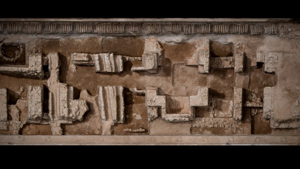
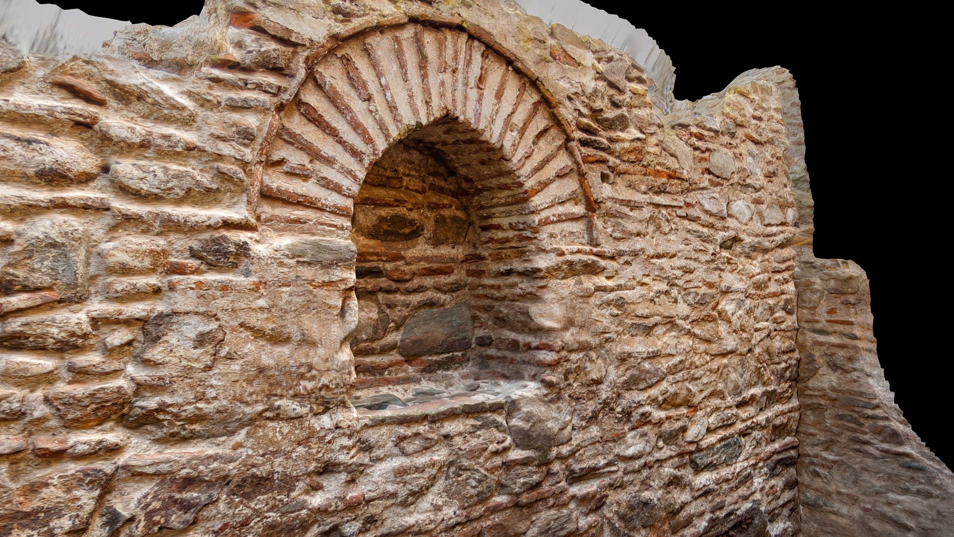
Metro Venizelou Excavation SC 03, 2010
Highly detailed Byzantine structural mapping at Venizelou Station (Sector SC 03) recorded during the archaeological excavations in 2010.
Explore the 3D Archives
Browse and interact with our extensive catalog of heritage fortifications, ancient monuments, and archaeological excavations.
Metro Venizelou Excavation SE (09/2008)
The South-East archaeological section at Venizelou station during the September 2008 documentation phase, showing early structural exposures.
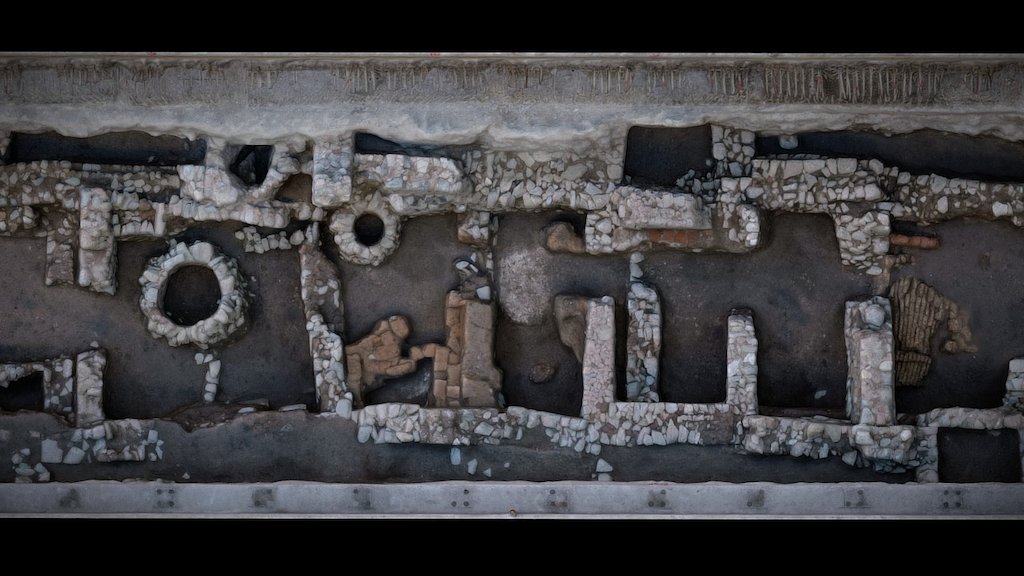
Metro Venizelou Excavation SE (12/2008)
Early photogrammetric documentation of the South-East section of the Venizelou Metro excavation, preserving the initial discovery layer of the Byzantine crossroads.

Metro Venizelou Excavation SC 03, 2010
Highly detailed Byzantine structural mapping at Venizelou Station (Sector SC 03) recorded during the archaeological excavations in 2010.
Metro Venizelou SW 03 A, 2009
Archaeological photogrammetry of the South-West sector (03 A) of the Byzantine crossroads under Egnatia street, documented in 2009.
Metro Venizelou SW 03 B, 2010
Structural 3D capture of the South-West sector (03 B) at the Venizelou excavation site, completed in 2010 to preserve archaeological relationships.
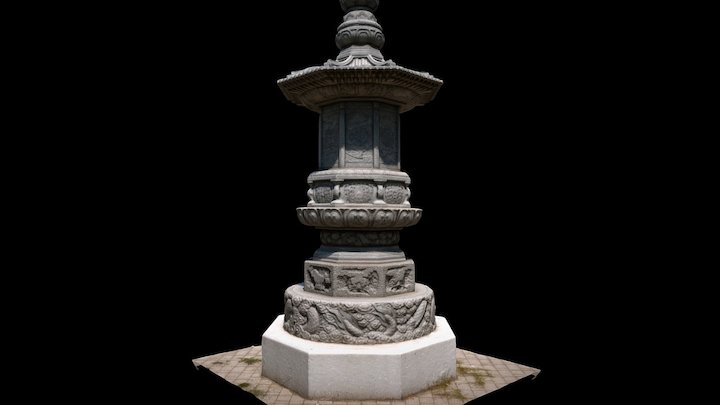
Korean War Memorial, 2014
3D spatial documentation of the monument dedicated to the Greek expeditionary force that fought in the Korean War.

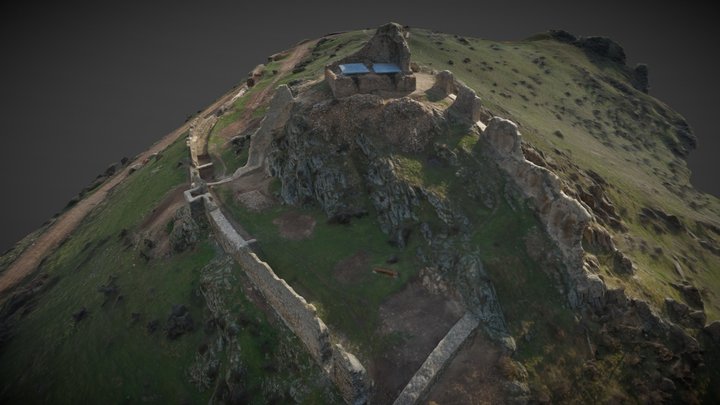
Eptapyrgio Fortress
A comprehensive photogrammetric reconstruction of the Eptapyrgio fortress, a Byzantine and Ottoman stronghold overlooking Thessaloniki's Acropolis.

Agios Vasileios Byzantine Tower, 2009
High-resolution 3D reconstruction of the medieval Byzantine tower located near Lake Koroneia, documented to support structural restoration analysis.

Byzantine Basilica of Servia
Spatial reconstruction of the monumental Byzantine Basilica located within the castle town of Servia in Kozani, preserving its historic ruins.

Artemision Castle, Rentina, 2009
The medieval fortification of Rentina (Artemision Castle) documented through ground-level and aerial photogrammetry in 2009, revealing its complex terrain layout.
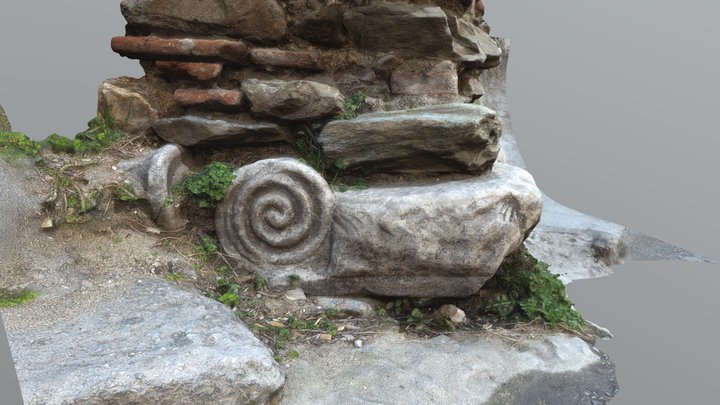
Re-purposed Ancient Greek Column
Detailed 3D model of an ancient Greek column showing signs of historical re-purposing (spolia) in later architectural phases.
Servia Castle Fortifications
Photogrammetric survey of the defensive walls and ruins of the Byzantine Castle at Servia, Kozani, capturing the structural complexity of the fortification.
Byzantine Fortress of Gynaikokastro, 2006
The ruins of the 14th-century Byzantine fortress at Palaio Gynaikokastro in Kilkis, digitally documented in 2006 using close-range photogrammetry.
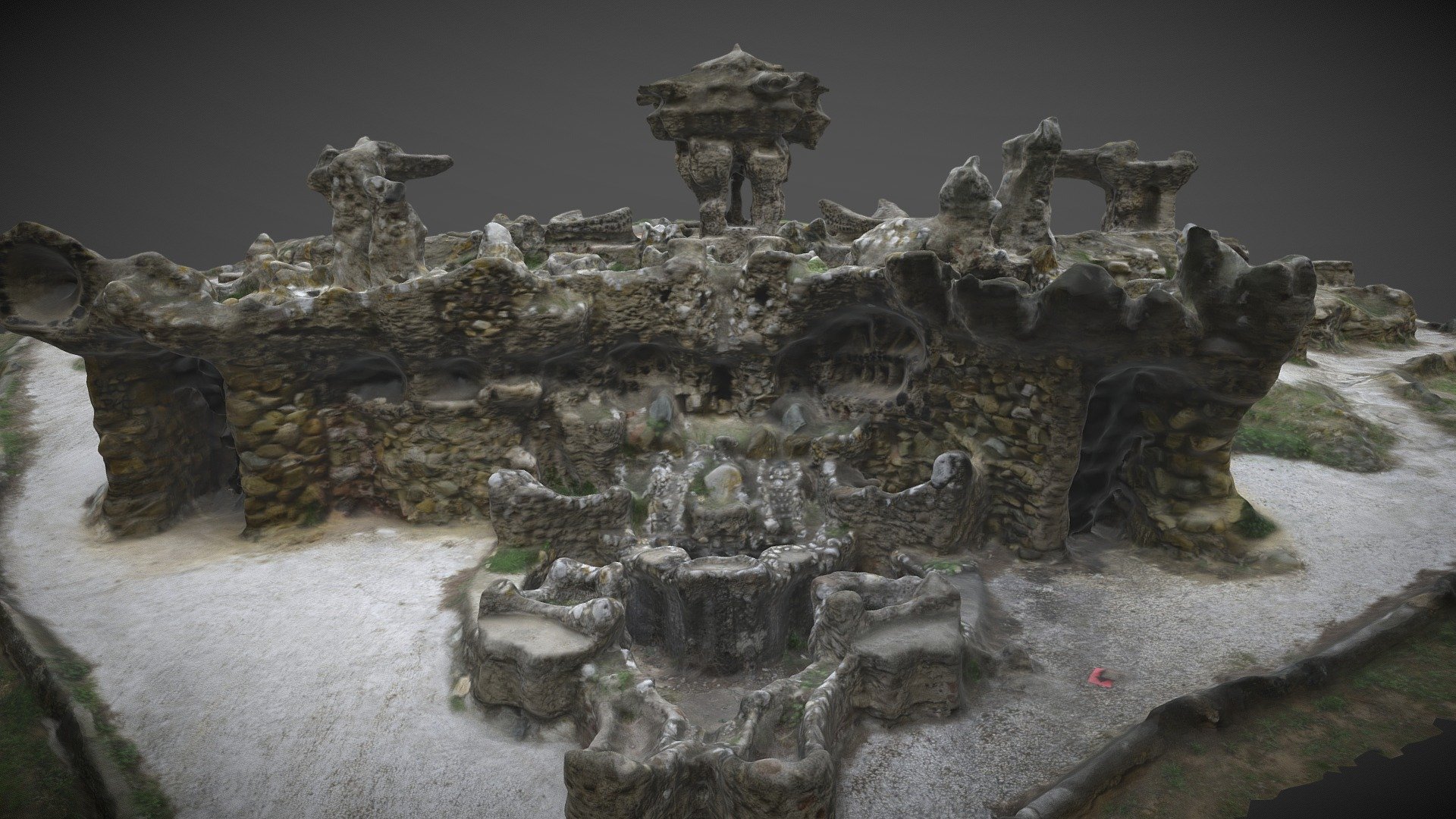
Gardens of the Pasha
3D reconstruction of the early 20th-century fantastic/oriental style stone structures at the Gardens of the Pasha in Thessaloniki.
Diocletianopolis Roman Walls
3D scanning and photogrammetric documentation of the late Roman fortifications of Diocletianopolis, located in modern-day Kastoria, Greece.
The 4-Step Reconstruction Process
Acquisition
Systematic capture of hundreds to thousands of high-resolution images, ensuring maximum overlap and correct angles for the algorithms to interpret depth.
Alignment
Software matches millions of key points across the dataset to reconstruct the exact camera positions and build a sparse point cloud.
Geometry
A dense point cloud is generated, representing the solid surface. This is then triangulated into a continuous 3D mesh.
Texturing
The original photographs are projected onto the 3D mesh to create a photorealistic, high-fidelity digital replica.