Gynaikokastro Castle: High-Angle Fortification Mapping
Aerial photogrammetry of the ruined medieval stone fortifications and tower of Gynaikokastro Castle in Kilkis.
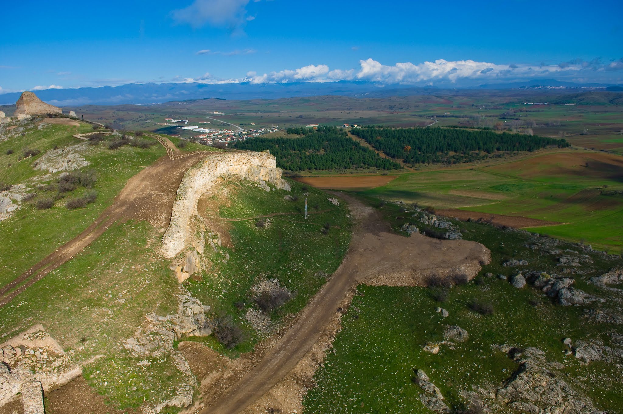
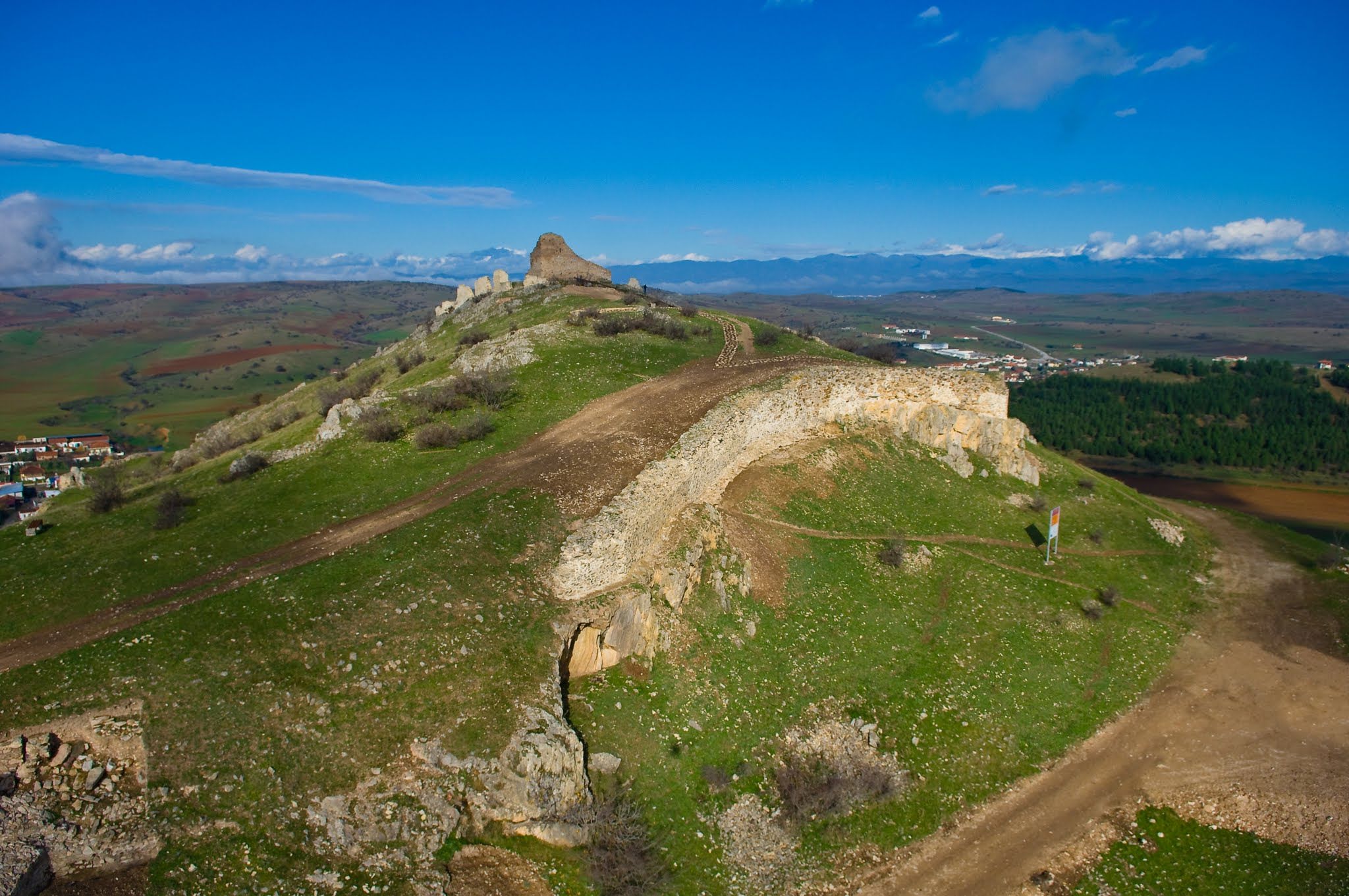
Located on a rocky, prominent hill in Kilkis, Gynaikokastro Castle features extensive medieval stone ruins and a central watchtower. The steep topography made ground-based mapping incredibly difficult.
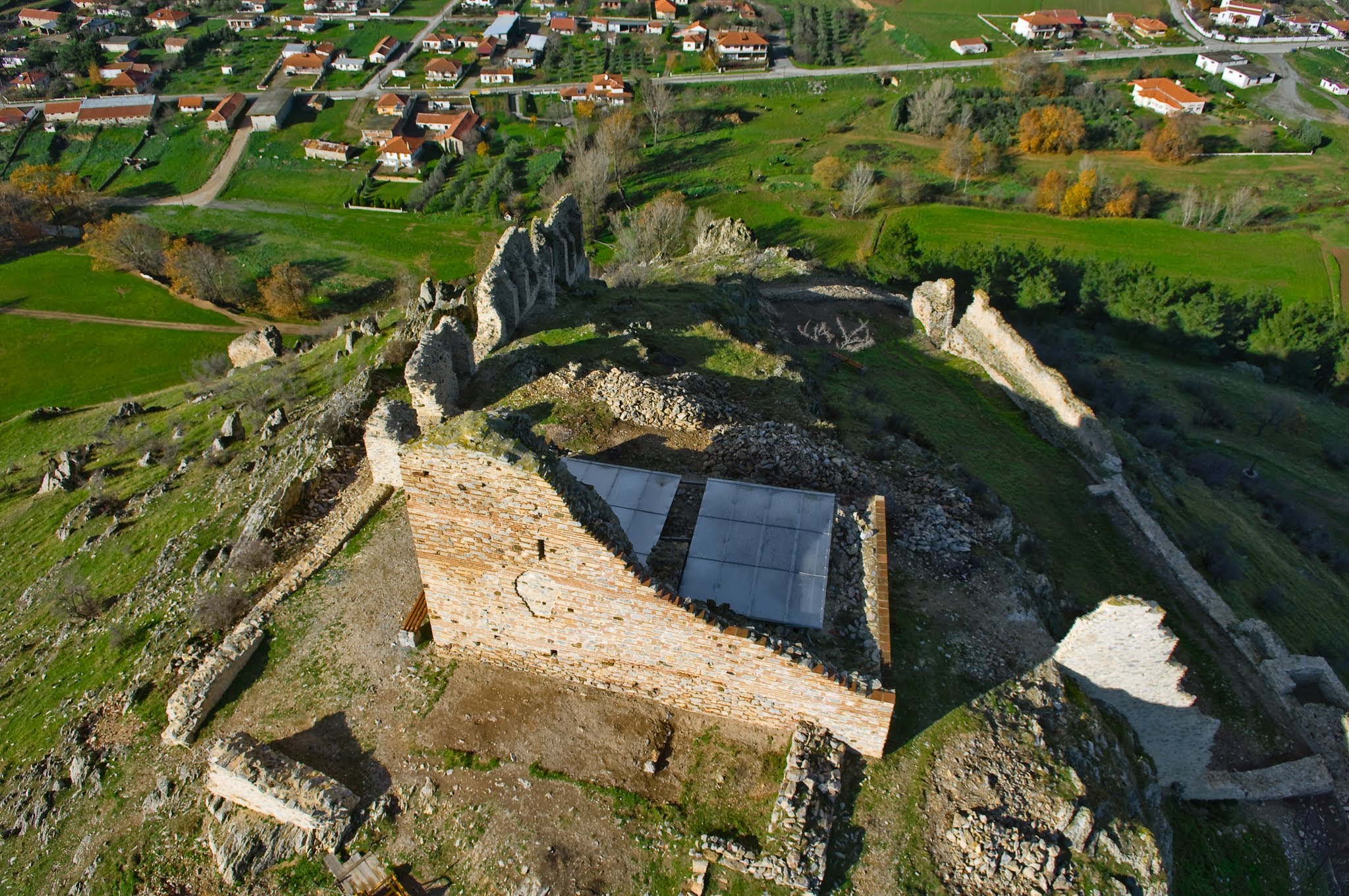
Using the HeliCam, we flew oblique passes and nadir mapping grids over the hilltop ruins. We documented the central tower (which is protected by a modern metal roof), the adjoining stone defensive walls, and the steep metal visitor staircases ascending the rocky slopes.

Technical Specs
- Date: June 2006
- Location: Ginekokastro, Greece
- Technology: Custom-built HeliCam Remote-Controlled Helicopter
- Imaging: DSLR Payload with Multi-Axis Gimbal Stabilization