Drone Photogrammetry & Rentina Castle: Capturing the Invisible from Above
Developing early airborne photogrammetry techniques using robotic camera platforms to capture metric-accurate Byzantine antiquities.
Aerial photogrammetry fundamentally changes what is possible in archaeological site documentation. My journey into spatial archival began in the late 2000s, driven by the need to capture scientifically correct, metric-accurate digital models of Byzantine antiquities.
The HeliCam Foundation
Before modern off-the-shelf drones existed, I spent years (2006-2008) researching and constructing custom 2-meter remote-controlled helicopters. These units were equipped with custom-built, stabilized robotic camera mounts—making them the first of their kind in Europe.
By 2009, this robotic photography platform allowed me to develop early forms of airborne photogrammetry.
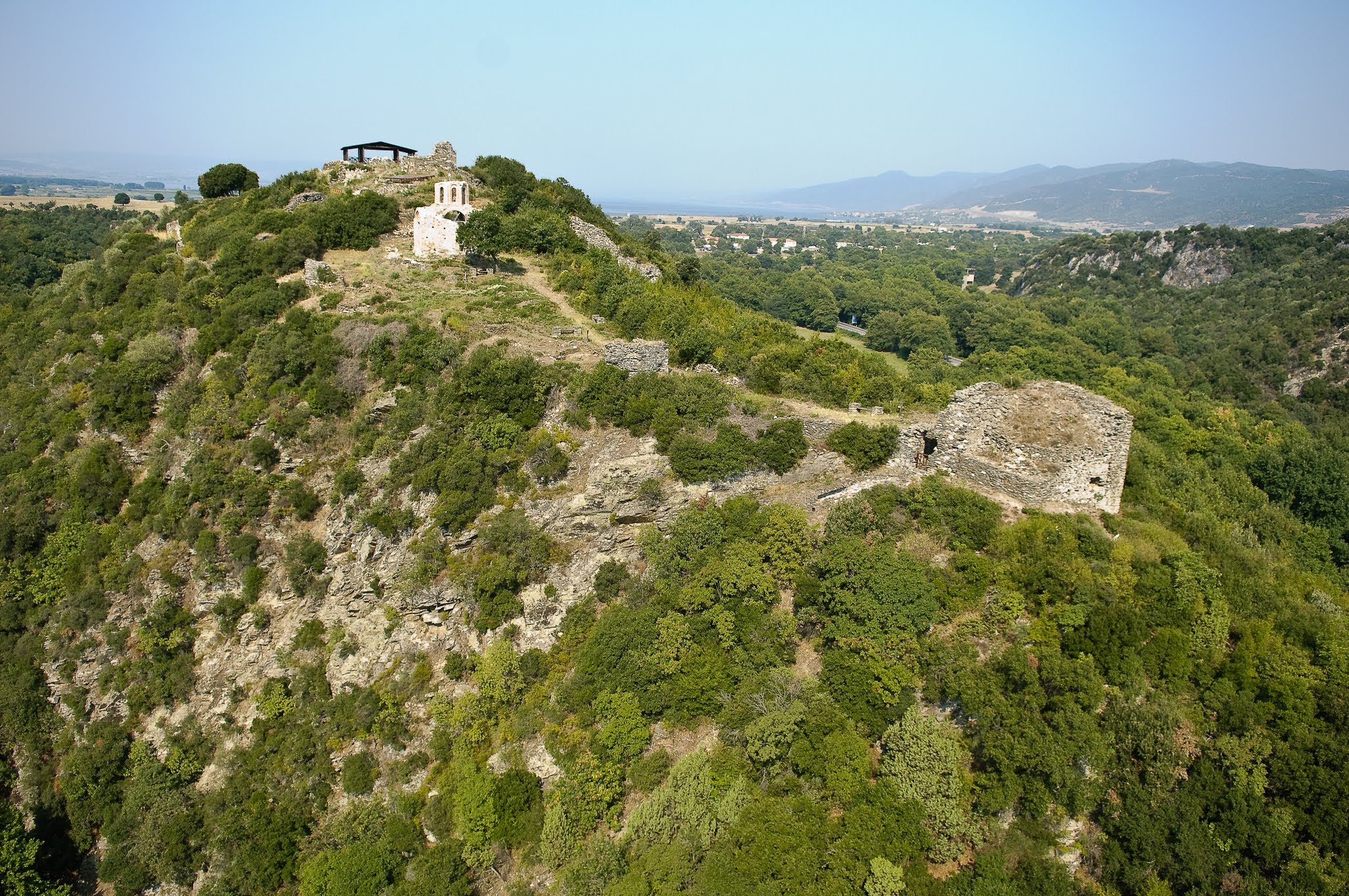
Artemision Castle in Rentina (2009)
One of the most significant early applications of this technology was the aerial survey and photogrammetry of the Artemision Castle in Rentina.
The workflow involved:
- Custom Flight Planning: Flying the 2-meter RC helicopter in tight grid patterns over the castle ruins.
- ReaLight Photography: Utilizing a proprietary lighting and photography technique I developed to capture the texture and depth of the stone walls without harsh shadows.
- Multi-Scale Integration: Combining high-altitude aerial passes with low-altitude oblique flights and ground-level terrestrial photography.
- Processing: Feeding the raw photographic data into early versions of Agisoft Photoscan to generate centimeter-accurate 3D digital twins.
Beyond Pretty Pictures
The deliverables from these early photogrammetry projects went far beyond traditional 3D models. We generated:
- Orthomosaic maps for archaeological record-keeping.
- Digital Elevation Models (DEMs) for topographic analysis of the hills surrounding the castle.
- Cross-section profiles to assess the structural integrity of the remaining Byzantine walls.
The ability to blend electro-mechanical prototyping (building the UAVs) with high-end digital imaging allowed us to unlock a new dimension of historical documentation, preserving sites that are difficult or dangerous to access by foot.